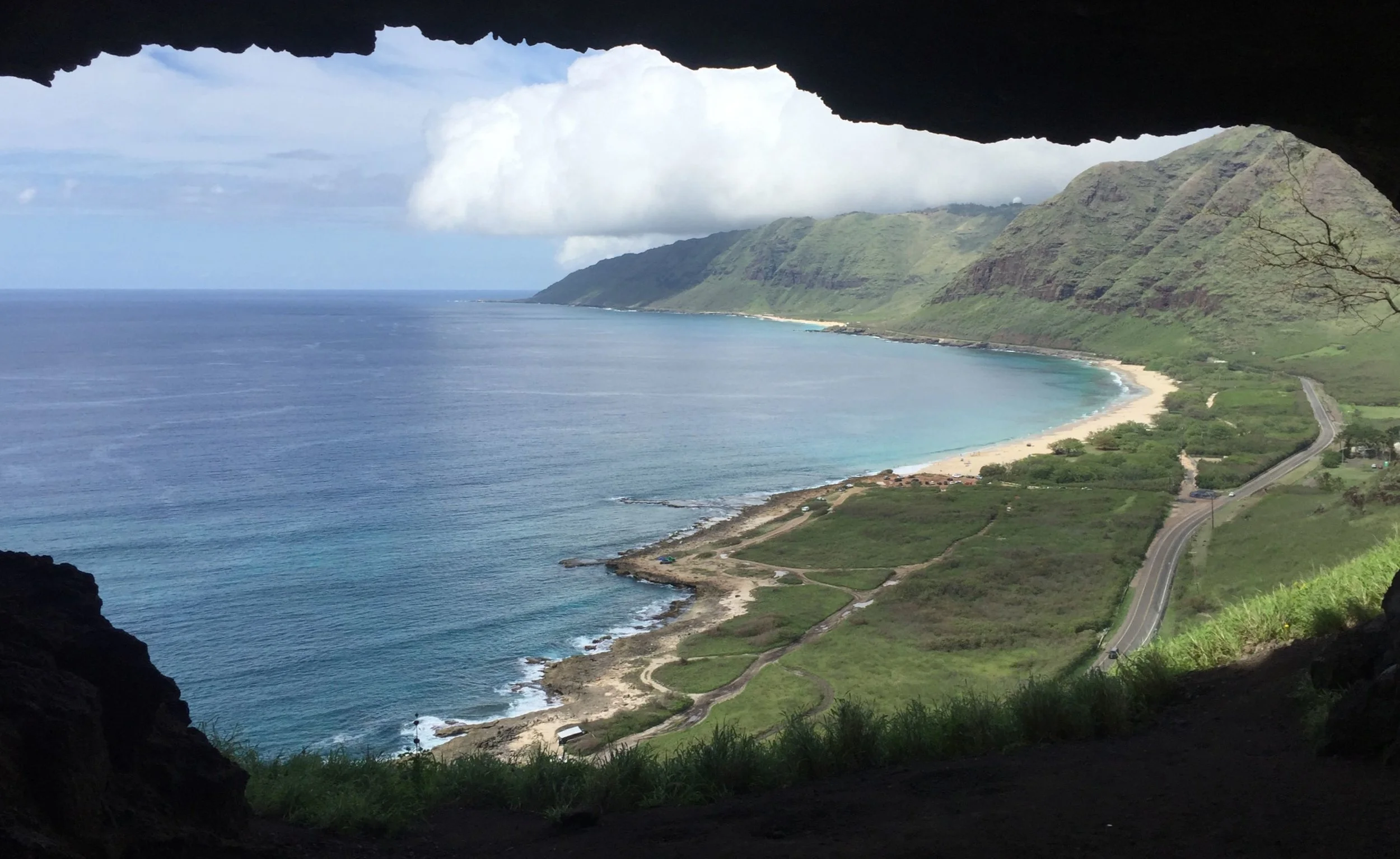
View Northward from Upper Makua Cave.
Most people will tell you that there are no caves on Oahu. Caves, in the Hawai’ian sense mean something much different here than on the mainland, more of a Pacific North West interpretation, which means we are talking about Lava Tubes as well. The Hawai’ian island chain, built up from volcanic eruptions has a large number of lava tubes. The Hawaiian Speleological Society has slightly over 1000 distinct entries in their records, the vast majority of which are located on the Big Island, or Hawai’i. (How’s that for confusing?) Here on Oahu, the volcanos are much older, and the relatively fragile lava has been eroded by wind, sea and rain for more than 2 millions years. Most lava tubes have collapsed, and only the faintest remnants remain. Soon after my arrival, I was disappointed to find all this out, but conversely, intrigued by the presence of Kaneana (Makua) Cave.

The entrance at Kaneana (Makua) Cave (Lava Tube).
Kaneana Cave is a heavily travel worn cave on the side of the road on western Oahu. At one time the inside was covered in spray paint, which, later on, was covered again with some sort of black tar-like substance. If there were any historic markings in the cave, they are long gone now. The cave is heavily traveled by tourists, equipped as those in the picture above, and fortunately for them, the cave is not particularly extensive. Though heavily damaged, the cave was intriguing. A short wander from here, brought me to a completely different kind of cave.

Properly attired tourists attempt to navigate the 8 foot stem up out of Mermaid Cave.
Using the ‘ol Google Cave Search, I was directed to a place called Mermaid Cave. Immediately upon arriving, I realized these were not going to be lava tubes. This cave was located in a thin bed of limestone, or possibly carbonate eolianite, no more than 15 feet thick. As I wandered around the island, It became apparent that this limestone layer was prevalent in many places around the island, and that many divers were diving in “lava tubes” in a place called Shark’s Cove. This was the area where we would start.

Armed with snorkeling gear, we began the search. Chrissy was relegated to surface pictures, with her newly broken arm.
Right away, we happened across shallow caves, easily accessed from the surface, and huge numbers of tourists and local divers. We started with snorkeling gear, but quickly realized this would take more equipment. Things progressed rapidly, and every trip required more and more gear, and earlier and arrivals to avoid the hordes of tourists.

Sidemount gear was the next step.
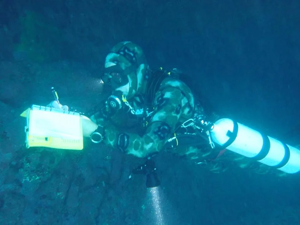
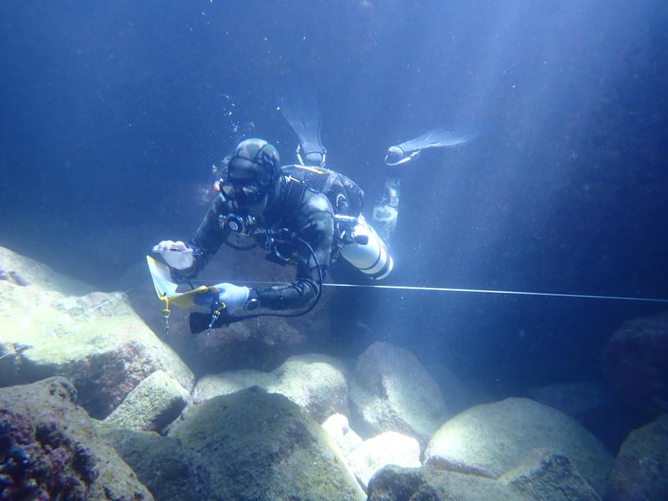
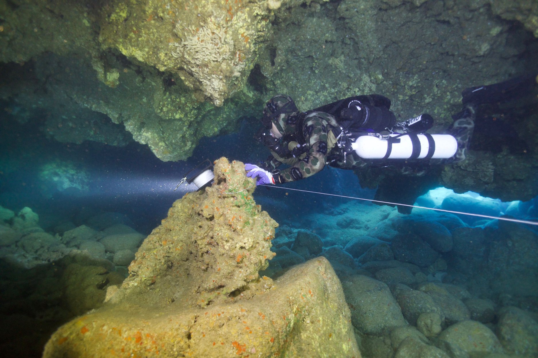
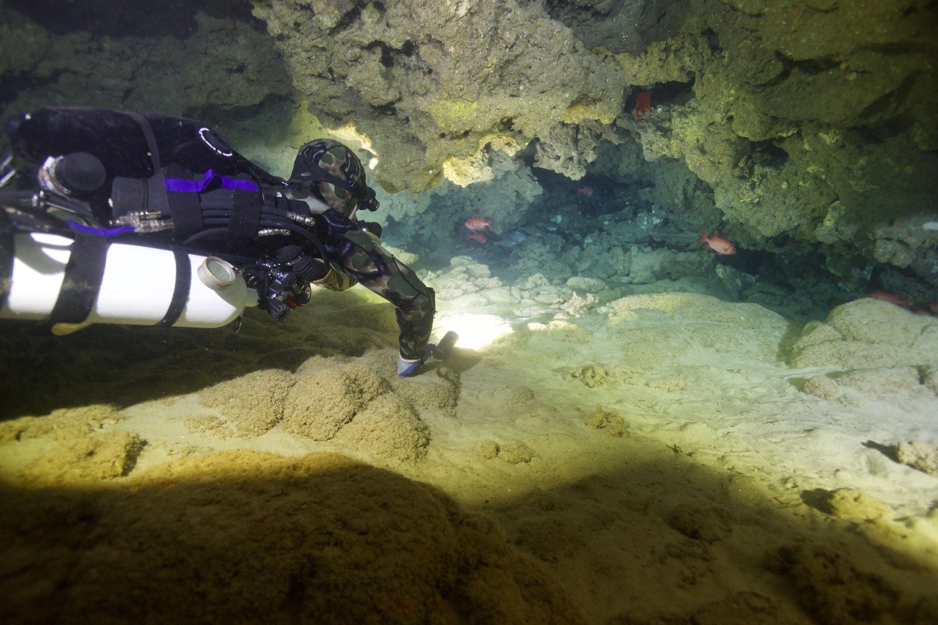
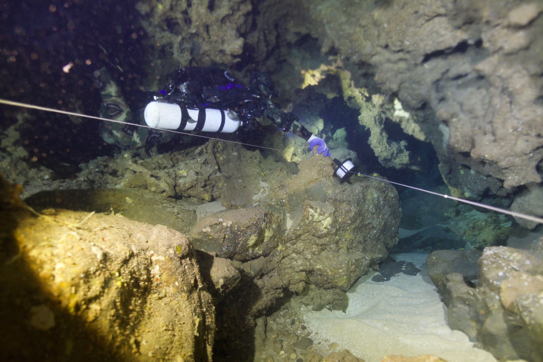
Soon, the first maps were being produced. Due to the high number of open water divers in the caves, we realized that we were not going to be able to leave any lines in the caves overnight. We had to work on one part of the cave at a time, then pull all the lines. I streamlined the process by doing an initial dive to lay line, then survey it. Then we would get out of the water, with someone pulling gear guard, I ran to the car, entered all the data and created the plot, which I transferred to the diving sketch sheets. Then we got back in the water for a second dive. I would sketch the cave, then either I or my dive buddies would pull all the lines from the cave. Starting at 7 AM we had lines in the cave for less than 4 hours at most, but in some cases, this was still WAY too long. Invariably open water divers would wander into the cave and become entangled.
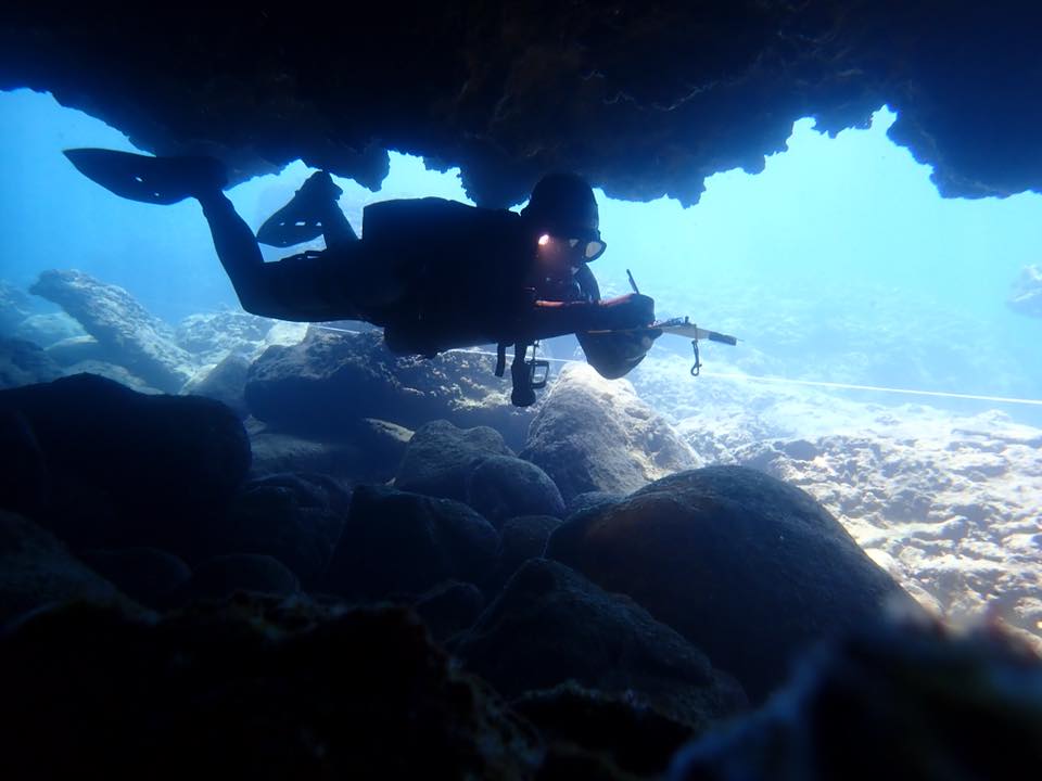
Sketching the cave on the second dive.
The survey progressed rapidly, and produced nine separate caves all in the same area. In total, the caves around Sharks Cove produced more than 2000 feet of cave passage, mostly in short stretches and mazy connections.

A portion of Bristley Cave, showing a popular feature called The Elevator. Unfortunately, three divers died here in 1987 when they failed to realize just how complex this little cave actually is.
Mapping continues around the island of Oahu, and there are rumors of many more caves (none of which are lava tubes, interestingly) below the water level here, and we will continue to catalog and map them as time allows!

Images above thanks to Heather Choate Armstrong, Kelly McCormick and Chrissy Richards